Tag Archives: No amenities

Coastal North Carolina, Dare County (NC)

This full Carolina Butterfly Society 2-day field trip will be held in coastal North Carolina where we plan on visiting several different locations. Our target butterfly species varies by location and are listed below. The leaders are Harry LeGrand and Lori Arent.

Saturday, September 6, 2025Alligator River National Wildlife Refuge – Meet at the small parking lot on the left side of Pamlico Road, about 200 yards from US 264, which is on the south side of the Dare County mainland (GPS coordinates 35.6132, -75.83282). Meet at 10:00 am. This is near the southern end of the large loop of US 264, about 7-8 miles south of Stumpy Point. Note that Pamlico Road is a single-track gravel road, and thus parking along the road is likely impossible; even parking along or very close to US 264 might be tricky or unfeasible.

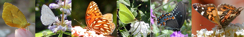
Targets: Palatka, Aaron’s, Berry’s, Yehl, Dion, Broad-winged, Twin-spot, Tawny-edged, and Carolina Roadside skippers.

We will have lunch in the field. There are no restrooms here. Depending on our time and success, whether the roadsides have been mowed, whether coastal storms have damaged the vegetation and the road, etc., we MAY make a short drive to a different site in the afternoon, on the northern side of US 264. That site has a different set of flowers — more Mistflower instead of the dominant Bitter Sneezeweed at Pamlico Road. If the roadsides have not been mowed or otherwise impacted, the target species are about the same; there is a higher chance (but still iffy) of Berry’s Skipper here, but less chance for brackish marsh species like Aaron’s Skipper. Just before the end of the day, we plan a brief stop to check the Lantanas at the Roanoke Island Visitor Center.

Sunday, September 7, 2025 – Various sites on the Dare County Outer Banks in the Kill Devil Hills, Duck, and Southern Shores areas; and perhaps also including a long drive to central mainland Currituck County – Meet at the large parking lot of Lowe’s Home Improvement, in the corner closest to US 158 and West Landing Drive (GPS coordinates 36.02594, -75.66886), in Kill Devil Hills. Meet at 9:00 am. The turn off US 158, the main north-south highway on the Banks, is the first major road to the west after passing the Wright Brothers National Memorial if driving from the south. If driving from the north, Lowe’s is just before you reach the Memorial.

Targets: Dukes’ Skipper, Eastern Giant Swallowtail, Brazilian Skipper.

At the meeting place, we will need to review what uncommon/rare species have been recently seen in the area, as this information will determine where we visit. We hope to find Dukes’ Skipper in the Duck area, as a few were seen in late July or early August and have been seen there years ago as well. If missed there, some or many folks may want to make the rather long drive to central Currituck County, where a rather large colony of Dukes’ Skipper has been seen in September in the past few years. We expect to visit a few gardens and other plantings in the Duck area to search for the Giant Swallowtail and the rare and sporadic Brazilian Skipper, and other species.

Lunch will presumably be in the field, but as there are numerous fast-food restaurants along US 158, with restrooms. Details for Sunday afternoon are wide open and will be determined by the successes of the morning.

For lodging, most of you have hopefully already made motel/hotel reservations, as this trip was announced in late winter or early spring. Certainly, lodging on the Outer Banks, and less so at Manteo on Roanoke Island, is expensive in early September, and many or most of these may well be already booked completely.

As stated previously, Harry LeGrand and Lori Arent will lead. Either register on the CBS website (using the “Register” link above) or RSVP to Harry at hlegrandjr@gmail.com or Lori at ljarent1@gmail.com if you plan to participate. Please bring water, lunch, binoculars, cameras and field guides. Sunscreen, bug spray, long pants and close-toed shoes are highly recommended.

CLOSED – Pre-Symposium Walk – Mason Farm Biological Reserve (Chapel Hill, NC)

CLOSED – We have had an overwhelming response to this year’s symposium and must close registrations due to resource limitations.

This is a pre-symposium butterfly walk but anyone is welcome whether they plan on attending the symposium or not.

We will meet at the parking lot at Mason Farm Biological Reserve trailhead. There is no street address, but the GPS coordinates are 35.89233, -79.01647. The walking loop is about 2 miles or so and is flat. The trail winds through several habitats including hardwood forest, mixed pine forest, open fields, and has a nice boardwalk section through a wetland. Approximately 60+ species of butterflies have been tallied here over the years and seasons. Of course, we will probably not have that diversity in September, but it’s still a nice walk. Jeff Pippen will lead.

No restrooms are available on the property. Please bring water, snacks (or a late lunch), binoculars, cameras and field guides. Sunscreen, bug spray, long pants and close-toed shoes are highly recommended.

Directions – From the north, drive to Finley Golf Course Road in Chapel Hill. Drive around the Finley Golf Club clubhouse and parking lot and past the driving range. Directly after the driving range at the power lines, take the right fork onto Mason Farm Acc Road (which passes under the power lines). After about 0.38 miles, turn to the right on the gravel access road to the creek, then drive over the concrete ford (which always has at least some water flowing over it, but should be passable). The trailhead parking lot is just to the south of the creek.

Please use the symposium registration form if you are attending the symposium and plan to participate. If you are NOT attending the symposium, you can register for this walk online at the CBS website or RSVP to Marty Kastner at kastners@aol.com.

Wateree River HP & WMA (Columbia City Nature Challenge – Eastover, SC)

The Carolina Butterfly Society Midlands Chapter will hold a butterfly walk on Sunday, April 27, 2025 which will be in conjunction with the Columbia City Nature Challenge. It is our local part of City Nature Challenge, an international four-day competition where cities across the globe compete to record the biodiversity of their urban and surrounding areas. We will focus on butterflies, but all nature entries on iNaturalist will count.

Meet at the first kiosk that is located on the right, about 0.45 miles along Goodwill Road after entering the property. GPS coordinates for the kiosk are 33.9495, -80.6530. The HP / WMA entrance is located at 15001 Goodwill Road, Eastover, SC 29044 (GPS coordinates 33.9435, -80.6555) on the north side of Garners Ferry Road, US Highway 378, almost across from Goodwill Baptist Church.

No restrooms are available on the property. Dave and Marty Kastner will lead. Either register on the CBS website (using the “Register” link above) or RSVP to Marty at the email address below if you plan to participate. Please bring water, lunch, binoculars, cameras and field guides. Sunscreen, bug spray, long pants and close-toed shoes are highly recommended. Let’s have a big turnout!!!

See the website link below for hiking trails and other information about the Wateree River Heritage Preserve and Wildlife Management Area.

Southern 8ths Farm & Cheraw SP (Chesterfield Co., SC)

On Sunday, March 23, 2025, tentative plans are for Tom Austin to lead a second-day SCAN trip to a new Southern 8ths property from 10:00 AM to 12:00 PM. Brad Turley, the Southern 8ths Farm owner, is in the process of buying land in Chesterfield County, adjacent to Cheraw State Park, located roughly at GPS coordinates 34.6604, -79.8907. He is interested in getting some eyes on that property while we’re in the area. A specific meeting location will be provided later.

Afterwards, those who wish can head over to Cheraw State Park in Patrick, SC on Society Hill Road.  The GPS coordinates for the meeting location are 34.6196, -79.9452. The target species are Brown Elfin, Henry’s Elfin, Hessel’s Hairstreak and Great Purple Hairstreak. There is also an option, if time permits and there is interest, to go to Carolina Sandhills NWR to look for Frosted Elfin. Walking is off trail and easy.

There are no restroom facilities. Tom Austin will lead the Southern 8ths walk and Dave and Marty Kastner will lead the Cheraw State Park walk and, if we go, Carolina Sandhills NWR walk. Either register on the CBS website (using the “Register” link above) or RSVP to Tom or Marty at one of the email addresses below if you plan to participate. Please bring water, lunch, binoculars, cameras and field guides. For any of these walks, sunscreen, bug spray, long pants and close-toed shoes are highly recommended.

RESCHEDULED – Wateree River HP & WMA (Southern Dogface – Eastover, SC)

THIS WALK HAS BEEN RESCHEDULED – Due to the weather forecast for rain, wind, low temperatures and no sun on October 11, this walk has been moved back 1 week to October 18.

The Carolina Butterfly Society Midlands Chapter will hold a butterfly walk on Saturday, October 18, 2025, at the 3,674-acre Wateree River Heritage Preserve and Wildlife Management Area. Our target species is Southern Dogface, but we will also be looking for other late-season butterflies as well. We will drive to various areas, walk some of the trails and quite possibly “bushwhack” through fields following the elusive Southern Dogface. Some areas may be a little overgrown, but the walking is mostly on level ground and easy.

Meet at the first kiosk that is located on the right, about 0.45 miles along Goodwill Road after entering the property. GPS coordinates for the kiosk are 33.9495, -80.6530. The HP / WMA entrance is located at 15001 Goodwill Road, Eastover, SC 29044 (GPS coordinates 33.9435, -80.6555) on the north side of Garners Ferry Road, US Highway 378, just across from Goodwill Baptist Church.

No restrooms are available on the property. Dave and Marty Kastner will lead. Either register on the CBS website (using the “Register” link above) or RSVP to Marty at the email address below if you plan to participate. Please bring water, lunch, binoculars, cameras and field guides. Sunscreen, bug spray, long pants and close-toed shoes are highly recommended.

See the website link below for hiking trails and other information about the Wateree River Heritage Preserve and Wildlife Management Area.

Coosawhatchie HP & WMA (Frosted Elfin – Yemassee, SC)

The Carolina Butterfly Society Midlands Chapter will hold a butterfly walk on Sunday, March 16, 2025, at the 10,879-acre Coosawhatchie Heritage Preserve and Wildlife Management Area. We will look for lupine and Baptisia tinctoria (horsefly weed) and a new population of Frosted Elfin, as well as other early-season butterflies. The walking is mostly on level ground and easy.

Meet at the Pocotaligo Road kiosk that is located about a quarter mile into the property. The property entrance on Pocotaligo Road is located at GPS coordinates 32.6916, -80.9193. Directions from I-95, take SC-68 West in Yemassee, exit#38. Turn onto Simmons Road and follow it to Pocotaligo Road.

No restrooms are available on the property. Refer to the SCDNR website link below for additional information and a map of the property. Either register on the CBS website (using the “Register” link above) or RSVP to our leader, Tom Austin, at the email address below if you plan to participate. Please bring water, lunch, binoculars, cameras and field guides. Sunscreen, bug spray, long pants and close-toed shoes are highly recommended.

Wateree River HP & WMA (Eastover, near Columbia, SC)

DATE CHANGE – Originally Saturday, March 8, 2025

The Carolina Butterfly Society Midlands Chapter will hold a butterfly walk on Saturday, March 1, 2025, at the 3,674-acre Wateree River Heritage Preserve and Wildlife Management Area. We will be looking for early-season butterflies, as well as a possible over-wintering Mourning Cloak or Southern Dogface. We will drive to various areas, walk some of the trails and quite possibly “bushwhack” through fields. Some areas may be a little overgrown, but the walking is mostly on level ground and easy.

Meet at the first kiosk that is located on the right, about 0.45 miles along Goodwill Road after entering the property. GPS coordinates for the kiosk are 33.9495, -80.6530. The HP / WMA entrance is located at 15001 Goodwill Road, Eastover, SC 29044 (GPS coordinates 33.9435, -80.6555) on the north side of Garners Ferry Road, US Highway 378, just across from Goodwill Baptist Church.

No restrooms are available on the property. Dave and Marty Kastner will lead. Either register on the CBS website (using the “Register” link above) or RSVP to Marty at the email address below if you plan to participate. Please bring water, lunch, binoculars, cameras and field guides. Sunscreen, bug spray, long pants and close-toed shoes are highly recommended.

See the website link below for hiking trails and other information about the Wateree River Heritage Preserve and Wildlife Management Area.

Peachtree Rock and Shealy’s Pond HPs (Brown Elfin – Lexington Co., SC)

DATE CHANGE – Originally Saturday, March 1, 2025

The Carolina Butterfly Society Midlands Chapter will hold a butterfly walk on Saturday, March 8, 2025, at the 460-acre Peachtree Rock Heritage Preserve and, if time permits, Shealy’s Pond Heritage Preserve. Our target species at Peachtree Rock is the Brown Elfin, but we will also be looking for other early-season butterflies as well.

Meet in the parking area next to Bethel United Methodist Church. The church address is 811 Peachtree Rock Road, Lexington, SC, and the GPS coordinates are 33.8334, -81.2012.

There are no facilities at this site, but gas stations and restaurants are nearby. Dave and Marty Kastner will lead. Either register on the CBS website (using the “Register” link above) or RSVP to Marty at the email address below if you plan to participate. Please bring water, lunch, binoculars, cameras and field guides. Sunscreen, bug spray, long pants and close-toed shoes are highly recommended.

Tillman Sand Ridge HP & WMA (Jasper Co., SC)

Tillman Sand Ridge Heritage Preserve and Wildlife Management Area is a preserve of about 2 square miles in the Outer Coastal Plain of western Jasper County, adjacent to the Savannah River. It was established to protect one of the northernmost populations of Florida gopher tortoises, eastern diamondback rattlesnakes, and many rare plant species. The preserve has examples of two important ecosystems, longleaf pine savanna and Outer Coastal Plain floodplain forest.

Directions: From the little village of Tillman (at the junction of Highways 336 and 321) turn onto Sand Hills Road. Continue on Sand Hills Road to the kiosk at a small parking area just off the left side of the road. GPS coordinates for the kiosk are 32.499295, -81.1999621.

There are no organized hunts at this location, but all participants should wear orange for the walk. Do not walk on any of the gopher tortoise mounds. There are no facilities at this site.

For those who need to stay overnight, hotels are available in Hardeeville.

Alison Smith will lead. Contact her at sweetgrassess@gmail.com if you plan on participating.

CANCELLED – Pre-Symposium Walk – Mason Farm Biological Reserve (Chapel Hill, NC)

CANCELLED – Due to damage, flooding and road closures from hurricane Helene, the CBS Board has decided to cancel the October 5 symposium and this walk that was scheduled for Friday, October 4.

LOCATION CHANGE (due to hunting at previous venue)

This is a pre-symposium butterfly walk but anyone is welcome whether they plan on attending the symposium or not.

We will meet at the parking lot at Mason Farm Biological Reserve trailhead. There is no street address, but the GPS coordinates are 35.89233, -79.01647. The walking loop is about 2 miles or so and is flat. The trail winds through several habitats including hardwood forest, mixed pine forest, open fields, and has a nice boardwalk section through a wetland. Approximately 60+ species of butterflies have been tallied here over the years and seasons. Of course, we will not have that diversity in October, but it’s still a nice walk. Jeff Pippen and Dave and Marty Kastner will lead.

No restrooms are available on the property. Please bring water, snacks (or a late lunch), binoculars, cameras and field guides. Sunscreen, bug spray, long pants and close-toed shoes are highly recommended.

Directions – From the north, drive to Finley Golf Course Road in Chapel Hill. Drive around the Finley Golf Club clubhouse and parking lot and past the driving range. Directly after the driving range at the power lines, take the right fork onto Mason Farm Acc Road (which passes under the power lines). After about 0.38 miles, turn to the right on the gravel access road to the creek, then drive over the concrete ford (which always has at least some water flowing over it, but should be passable). The trailhead parking lot is just to the south of the creek.

Please use the symposium registration form if you are attending the symposium and plan to participate. If you are NOT attending the symposium, you can register for this walk online at the CBS website or RSVP to Marty Kastner at the email address below.