This will be a joint outing with SCAN (South Carolina Association of Naturalists) to Mount Pisgah, located in the North Carolina section of the Blue Ridge Parkway. Information from SCAN is included below.
===== Start of SCAN Information =====
We will meet at the first Mount Pisgah parking lot to enjoy the views at Buck Spring and for our greetings with photo shoot. There are a few trails to explore from here.
We welcome the Carolina Butterfly Society to join us.
Mount Pisgah Trail
Trail begins at the far end of the Mount Pisgah Parking Area. 1.8 miles to the summit, the first 0.5 miles is fairly flat. The remaining 1.2 miles is moderate to strenuous. Lots of rock steps, for an ascent of 712 feet.
The trail passes through a forest of Northern Red Oaks, maples, birches and pockets of rhododendrons and mountain laurel to a deciduous heath bald at the summit at 5721 feet. An observation deck for a 360-degree view and the transmission tower sit at the summit. To the NE views of Craggy mountains, Asheville and the French Broad River Valley, to the West Shining Rock Wilderness and Cold Mountain and to the SW Looking Glass.
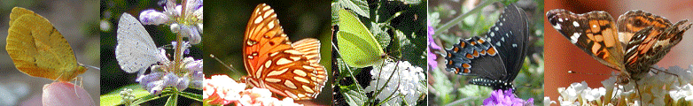
Most of the wildflowers can be seen for the first 0.5 miles. White snake root, Jeruselum artichoke, bee balm, Angelica, Prunella vulgaris Self heal and purple flowering raspberry Rubus odoratus, Joe-Pye weed a butterfly magnet, lots of ferns and mushrooms. Listen for the dark eyed juncos and warblers along the trail. Peregrine falcons are commonly spotted at the summit. Many wildflowers are native and some endangered.
Buck Spring Trail
This 1.1 mile-long portion of the Mountains-to-Sea Trail runs between the Mount Pisgah Inn and the Buck Spring Gap Parking Area. The trail passes the site where the mountain cabin of George Vanderbilt’s and Buck Spring Lodge once stood.
Shut In Trail
16.3 miles long and descends over 3,000 feet. Walk the trail in as far as you like and return to back track out.
Directions
From Asheville there are numerous paths to get to the BRP. From Bent Creek River Park/NC Arboretum on NC191, hop onto the BRP and head south, approximately 10 miles, to Milepost 407. Turn left into Mount Pisgah Parking area. Park at the first parking area Buck Spring Gap. Along the BRP there are several tunnels. Check that your headlights are off when you park.
GPS coordinates for Buck Spring overlook: 35.416017, -82.748378
There are 2 parking lots at Mount Pisgah. The first is Buck Spring Gap Overlook where we will meet. If you continue N 0.2 miles you will reach the 2nd parking lot. You can easily walk in between the two lots via road or take a trail. The Mount Pisgah trailhead is located at the far end of the second parking lot.
Lodging and Food
Pisgah campground is a little less than a mile and a half away. There is a trail from the campground to Mount Pisgah trail head.
Pisgah Inn is only a mile away at Milepost 408 which has rooms available with great views. They have a nice observation deck, restrooms and a good restaurant. Restaurant fills quickly so make a reservation if you would like to eat dinner. Dinner served from 5:00 to 9:00 PM. Phone: (828) 235-8228, Website: www.pisgahinn.com
There are restrooms located at entrance to Pisgah Inn parking lot.
Temps are cooler in the mountains. Come join and SCAN with us!
===== End of SCAN Information =====
See the website link below for hiking trails and other information about Mount Pisgah.