Tag Archives: Walk Difficulty: Easy

RESCHEDULED – Wateree River HP & WMA (Southern Dogface – Eastover, SC)

THIS WALK HAS BEEN RESCHEDULED – Due to the weather forecast for rain, wind, low temperatures and no sun on October 11, this walk has been moved back 1 week to October 18.

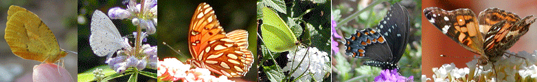
The Carolina Butterfly Society Midlands Chapter will hold a butterfly walk on Saturday, October 18, 2025, at the 3,674-acre Wateree River Heritage Preserve and Wildlife Management Area. Our target species is Southern Dogface, but we will also be looking for other late-season butterflies as well. We will drive to various areas, walk some of the trails and quite possibly “bushwhack” through fields following the elusive Southern Dogface. Some areas may be a little overgrown, but the walking is mostly on level ground and easy.

Meet at the first kiosk that is located on the right, about 0.45 miles along Goodwill Road after entering the property. GPS coordinates for the kiosk are 33.9495, -80.6530. The HP / WMA entrance is located at 15001 Goodwill Road, Eastover, SC 29044 (GPS coordinates 33.9435, -80.6555) on the north side of Garners Ferry Road, US Highway 378, just across from Goodwill Baptist Church.

No restrooms are available on the property. Dave and Marty Kastner will lead. Either register on the CBS website (using the “Register” link above) or RSVP to Marty at the email address below if you plan to participate. Please bring water, lunch, binoculars, cameras and field guides. Sunscreen, bug spray, long pants and close-toed shoes are highly recommended.

See the website link below for hiking trails and other information about the Wateree River Heritage Preserve and Wildlife Management Area.

SI Group Hundred Acre Woods (Goatweed Leafwing – Orangeburg, SC)

The Carolina Butterfly Society Midlands Chapter will hold a butterfly walk on Saturday, October 4, 2025, at the SI Group Hundred Acre Woods in Orangeburg, South Carolina.  Our target species will be the Goatweed Leafwing (we believe there is an existing, ongoing colony), but we will also be looking other fall butterflies. The walk will be on flat ground, but some field areas may be overgrown. There will be a short drive on an unpaved road to get to our staging point, and, after parking, we will walk around the property.

We will meet at the access road to the Hundred Acre Woods. The address is 725 Cannon Bridge Road, Orangeburg, SC 29115 (GPS coordinates 33.4651, -80.8841). Traveling south on Cannon Bridge Road from Highway 301, go past the railroad crossing and come in the third entrance on the left just after the main parking lot area for the SI Group and just before the fenced-in electrical substation enclosure. After turning in, look to your right and follow the short dirt road, on the east side of the electrical substation enclosure, towards the tree line where we will meet and line up our cars. After everyone has arrived, a safety officer from the SI Group will lead the caravan of cars back to the Hundred Acre Woods parking area.

There may be a porta potty on site. Restaurants and gas stations are nearby. Diane Curlee will lead. Either register on the CBS website (using the “Register” link above) or RSVP to Diane at the email address below if you plan to participate. Please bring water, lunch, binoculars, cameras and field guides. Sunscreen, bug spray, long pants and close-toed shoes are highly recommended.

Gum Swamp Road (Jackson, SC)

The Carolina Butterfly Society Midlands Chapter will hold a butterfly walk on Saturday, August 9, 2025, to areas near Aiken, South Carolina.  We will drive along Gum Swamp Road and stop at various locations along the road to explore areas of interest (or wherever we see butterflies). Our target species are the Texan Crescent, Tawny Emperor, and Hackberry Emperor, but we will also be looking for other summer butterflies as well.

We will meet at the Kathwood Lakes parking area (GPS coordinates 33.3373, -81.8435) of the Silver Bluff Audubon Center and Sanctuary. We will leave some cars at this location and consolidate the number of vehicles. Kathwood Lakes is located on Silver Bluff Road just before the paved road turns to dirt and approximately 200 yards after crossing the railroad tracks coming south. Kathwood Lakes is the name Google Maps uses for the bodies of water at this location.

If you are coming from the north, Beech Island is the nearest place with bathrooms, places to eat and gas stations. If coming from the south, Jackson is the nearest place for these items. If coming from the east down Silver Bluff Road, (SC 302), Aiken will be the last town on your way. Jackson will be to your south on SC 125 if you need to stop just prior to the meeting spot.

No restrooms are available along Gum Swamp Road. John Demko will lead. Either register on the CBS website (using the “Register” link above) or RSVP to John at the email address below if you plan to participate. Please bring water, lunch, binoculars, cameras and field guides. Sunscreen, bug spray, long pants and close-toed shoes are highly recommended.

NABA Butterfly Count (CSRV, Aiken County, SC)

On Saturday, July 12, 2025, NABA (North American Butterfly Association) will hold a butterfly count in the CSRV (Central Savannah River Valley) at the Silver Bluff Audubon Center in Jackson, South Carolina. Audubon’s Silver Bluff Sanctuary is a 3,400-acre woodland overlooking the Savannah River. Here you’ll find extensive pine forests and bottomland hardwood forests; beautiful walking trails; 50 acres of lakes and ponds; 100 acres of grassland; and all manner of birds, butterflies and wildlife. Refer to the website below for specific directions and additional information about Silver Bluff Sanctuary.

Meet at the Silver Bluff Audubon Visitor Center in Jackson, South Carolina. The GPS coordinates for the gate just outside the visitor center are 33.32451, -81.84501. The street address is 4542 Silver Bluff Road, Jackson, SC 29831. Important note: Using the street address, some GPS systems tell you that you’ve arrived one mile before you actually reach the Silver Bluff gates. At that point, Silver Bluff Road transitions from a paved road to a well-maintained sand/clay road. Continue driving for one more mile and you’ll see the gates on your right. As stated earlier, the GPS coordinates above are for the gate located just outside the visitor’s center.

The restroom at the visitor center will be accessible at the beginning of the day and at lunchtime.  We will eat lunch at the picnic area by the visitor center. John Demko will lead. Either register on the CBS website (using the “Register” link above) or RSVP to John at the email address below if you plan to participate. Please bring water, lunch, binoculars, cameras and field guides. Sunscreen, bug spray, long pants and close-toed shoes are highly recommended.

Carolina Sandhills NWR (Hairstreaks – near McBee, SC)

The Carolina Butterfly Society Midlands Chapter will hold a butterfly walk on Saturday, May 31, 2025, at the 47,850-acre Carolina Sandhills NWR (National Wildlife Refuge) in Chesterfield County, South Carolina. Our target species will be all the Hairstreaks, including Banded, Coral and King’s, but we will also be looking for other late spring butterflies as well.

Please meet in the parking lot at the visitor center of Carolina Sandhills NWR. The main entrance is on US Highway 1, about 4 miles northeast of McBee, SC. The address is 23734 U.S. Highway 1, McBee, SC 29101, and the GPS coordinates are 34.5026, -80.2237.

There are restroom facilities at Lake Bee, but we will not be near there until later in the day. There are also gas stations in McBee. We will drive to different sections of the NWR and stop to look for butterflies. Walking will be minimal and should be easy, but some fields may be overgrown. Dave and Marty Kastner will lead. Either register on the CBS website (using the “Register” link above) or RSVP to Marty at the email address below if you plan to participate. Please bring water, lunch, binoculars, cameras and field guides. Sunscreen, bug spray, long pants and close-toed shoes are highly recommended.

Sumter NF, Enoree District (Whitmire, SC)

The Carolina Butterfly Society Midlands Chapter will hold a butterfly walk on Saturday, April 19, 2025, to the Enoree District of the Sumter National Forest in South Carolina. Possible species are the Juniper Hairstreak, Pepper and Salt Roadside Skipper, and Common Roadside Skipper, but we will also be looking for other early-season butterflies as well. If we get really lucky, we may even spot a Dusted Skipper.

Meet at the BP gas station on Highway 66, Whitmire Highway, just off I-26 at exit 60. The GPS coordinates of the gas station are 34.4383, -81.7628. We will then drive to various parts of the forest.  Walking will be minimal.

There are bathrooms in the camping area of Sumter National Forest, but we may not be near them. There is also a rest stop on westbound I-26 shortly before exit 60. Dave and Marty Kastner will lead. Either register on the CBS website (using the “Register” link above) or RSVP to Marty at the email address below if you plan to participate. Please bring water, lunch, binoculars, cameras and field guides. Sunscreen, bug spray, long pants and close-toed shoes are highly recommended.

Coosawhatchie HP & WMA (Frosted Elfin – Yemassee, SC)

The Carolina Butterfly Society Midlands Chapter will hold a butterfly walk on Sunday, March 16, 2025, at the 10,879-acre Coosawhatchie Heritage Preserve and Wildlife Management Area. We will look for lupine and Baptisia tinctoria (horsefly weed) and a new population of Frosted Elfin, as well as other early-season butterflies. The walking is mostly on level ground and easy.

Meet at the Pocotaligo Road kiosk that is located about a quarter mile into the property. The property entrance on Pocotaligo Road is located at GPS coordinates 32.6916, -80.9193. Directions from I-95, take SC-68 West in Yemassee, exit#38. Turn onto Simmons Road and follow it to Pocotaligo Road.

No restrooms are available on the property. Refer to the SCDNR website link below for additional information and a map of the property. Either register on the CBS website (using the “Register” link above) or RSVP to our leader, Tom Austin, at the email address below if you plan to participate. Please bring water, lunch, binoculars, cameras and field guides. Sunscreen, bug spray, long pants and close-toed shoes are highly recommended.

Wateree River HP & WMA (Eastover, near Columbia, SC)

DATE CHANGE – Originally Saturday, March 8, 2025

The Carolina Butterfly Society Midlands Chapter will hold a butterfly walk on Saturday, March 1, 2025, at the 3,674-acre Wateree River Heritage Preserve and Wildlife Management Area. We will be looking for early-season butterflies, as well as a possible over-wintering Mourning Cloak or Southern Dogface. We will drive to various areas, walk some of the trails and quite possibly “bushwhack” through fields. Some areas may be a little overgrown, but the walking is mostly on level ground and easy.

Meet at the first kiosk that is located on the right, about 0.45 miles along Goodwill Road after entering the property. GPS coordinates for the kiosk are 33.9495, -80.6530. The HP / WMA entrance is located at 15001 Goodwill Road, Eastover, SC 29044 (GPS coordinates 33.9435, -80.6555) on the north side of Garners Ferry Road, US Highway 378, just across from Goodwill Baptist Church.

No restrooms are available on the property. Dave and Marty Kastner will lead. Either register on the CBS website (using the “Register” link above) or RSVP to Marty at the email address below if you plan to participate. Please bring water, lunch, binoculars, cameras and field guides. Sunscreen, bug spray, long pants and close-toed shoes are highly recommended.

See the website link below for hiking trails and other information about the Wateree River Heritage Preserve and Wildlife Management Area.

Webb Wildlife Center WMA (Hampton Co., SC)

The Webb Wildlife Center, owned and operated by the South Carolina Department of Natural Resources, is a management and research facility designed to demonstrate multiple-use wildlife and timber management. Meet in front of the WMA offices/visitor center. The restrooms are inside the visitor center which is closed on weekends.

Directions: From Columbia take Highway 321 South to Garnett. In Garnett, the road will fork, stay right on Hwy 119, turn right onto Augusta Stagecoach Road (S-20) (Across from Garnett Post Office), cross railroad tracks, go approximately 2.6 miles to James W. Webb Wildlife Management Area Entrance on the left and follow it (1.5 miles) to the office. GPS coordinates are 32.59086, -81.31240

Alison Smith will lead. Contact her at sweetgrassess@gmail.com if you plan on participating.

Tillman Sand Ridge HP & WMA (Jasper Co., SC)

Tillman Sand Ridge Heritage Preserve and Wildlife Management Area is a preserve of about 2 square miles in the Outer Coastal Plain of western Jasper County, adjacent to the Savannah River. It was established to protect one of the northernmost populations of Florida gopher tortoises, eastern diamondback rattlesnakes, and many rare plant species. The preserve has examples of two important ecosystems, longleaf pine savanna and Outer Coastal Plain floodplain forest.

Directions: From the little village of Tillman (at the junction of Highways 336 and 321) turn onto Sand Hills Road. Continue on Sand Hills Road to the kiosk at a small parking area just off the left side of the road. GPS coordinates for the kiosk are 32.499295, -81.1999621.

There are no organized hunts at this location, but all participants should wear orange for the walk. Do not walk on any of the gopher tortoise mounds. There are no facilities at this site.

For those who need to stay overnight, hotels are available in Hardeeville.

Alison Smith will lead. Contact her at sweetgrassess@gmail.com if you plan on participating.